THOUSAND OAKS, Calif. – October 19, 2020 – Tomorrow, October 20, is an exciting day for planetary science. NASA’s ambitious OSIRIS-REx asteroid rendezvous mission will attempt to sample the surface of asteroid Bennu to retrieve material that will be returned to Earth in September 2023. A decade of preparation on the ground led to a September 2016 launch and December 2018 arrival at the near-Earth asteroid Bennu. For the past 20 months, the spacecraft has studied Bennu to determine where to take the sample and how to do it safely. Teledyne Technologies Incorporated (NYSE:TDY) provided the digital “eyes” that are critical for the mission. These imaging technologies have operated flawlessly during the entire mission, taking visible images, measuring surface topology, and using visible-infrared spectroscopy to assess surface material composition.
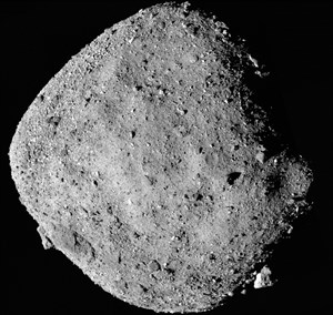
The visible images of the asteroid were taken with Teledyne CCD sensors. The entire asteroid and a close up of the landing site are shown below.
 |
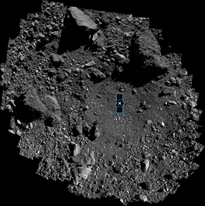 |
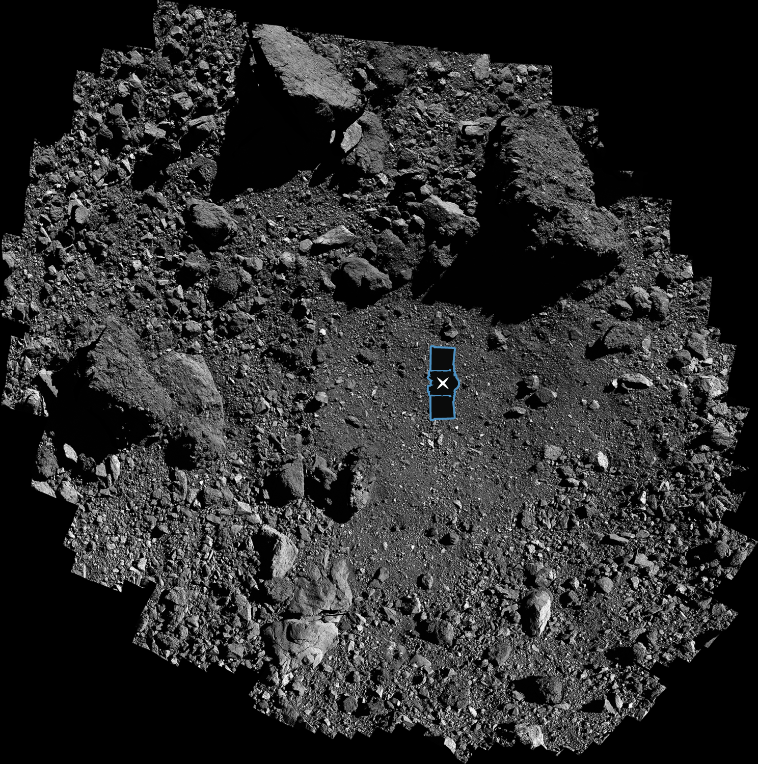
Asteroid Bennu is shown at left. The sample site, named “Nightingale”, is shown at right. The image is overlaid with a graphic of the OSIRIS-REx spacecraft to illustrate the targeted touchdown site which is ringed by dangerous obstacles. These imagery were taken with Teledyne CCD image sensors.
Image credits: NASA/Goddard/University of Arizona
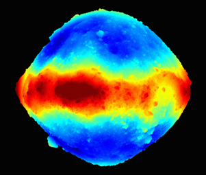
Bennu has a much more hazardous landscape that anyone envisioned before the spacecraft arrived. The 500-meter wide asteroid (a bit larger than the 433-meter tall Empire State building in New York City) has very large boulders on its surface; the largest is 58 meters wide and 22 meters tall! Any sizable boulder could damage the spacecraft as it approaches the surface. A vital instrument on the spacecraft is the lidar system that measured Bennu in three dimensions (3-D) to 10 cm accuracy and the landing site to 1 cm accuracy. Teledyne provided the two lidars that are on the OSIRIS-REx spacecraft.
 |
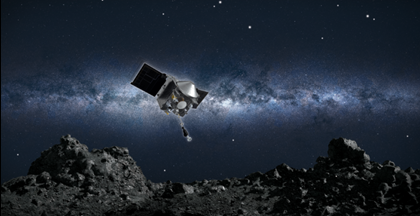 |
(Right) Artist conception of the spacecraft collecting a sample from the asteroid Bennu. Teledyne’s lidar mapped the rocky surface to enable the spacecraft to avoid hazards.(Left) Three-dimensional view of asteroid Bennu created from 20 million lidar measurements. The lidar system obtained these measurements by firing laser pulses at Bennu and measuring the amount of time it takes for the light to bounce off the asteroid’s surface and return to the instrument. The time delay is translated into altitude data. The colors represent the distance from the center of Bennu: dark blue areas lie approximately 60 meters lower than peaks indicated in red.
Image credits: NASA/Goddard/University of Arizona
But where to sample? Site selection depends on the composition of the surface material. Chemical composition is determined by spectroscopy that spreads visible and infrared light into hundreds of colors. Since every element, molecule, and mineral has a unique spectral “fingerprint”, the spectrometer assessed surface composition so that the most scientifically valuable site will be sampled. Teledyne’s visible-infrared image sensor detected the light in the spectrograph.
“Teledyne is proud to be a partner in the OSIRIS-REx mission with several imaging and spectroscopy technologies provided by our Digital Imaging segment,” said Robert Mehrabian, Executive Chairman of Teledyne. “Our contribution to this mission exemplifies Teledyne’s broad commitment to exploration and discovery, from the ocean floor to deep space.”
More information on the instruments and Teledyne image sensor technology is provided in the following paragraphs.
OSIRIS-REx is an acronym that incorporates the mission’s major concepts and goals: Origins, Spectral Interpretaion, Resource Identification, Security and Regolith Explorer. The mission is helping scientists investigate how planets formed and how life began, as well as improving our understanding of asteroids that could impact Earth.
About Teledyne Technologies
Teledyne Technologies is a leading provider of sophisticated instrumentation, digital imaging products and software, aerospace and defense electronics, and engineered systems. Teledyne Technologies’ operations are primarily located in the United States, Canada, the United Kingdom, and Western and Northern Europe. For more information, visit Teledyne Technologies’ website at www.teledyne.com.